Understanding roads, maintenance and spending
Published on 20 May 2022

Have your say on Integrated Planning & Reporting today!
We’re seeking your thoughts and feedback on our draft Integrated Planning & Reporting documentation until Monday 6 June 2022. These plans and financial documents will shape our region and Council’s future for years to come, please have your say today.
To assist the community in understanding the plans and documents on exhibition, we’re providing information and insights into key aspects of Council’s operations. This week we’re talking all about roads, their maintenance, and the funding we spend on them.
Your region's roads stats... did you know we have:
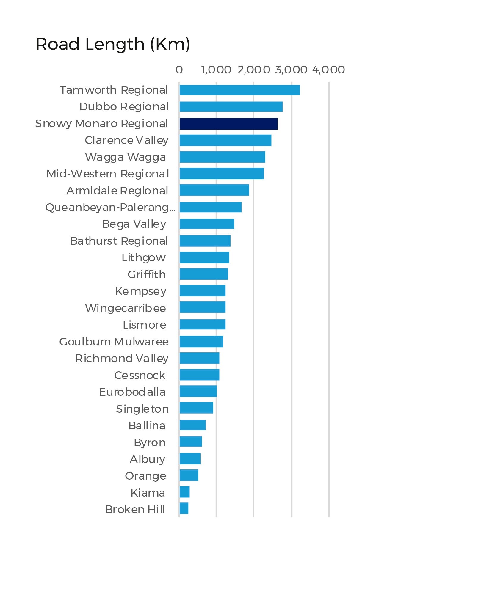
- A total road network of 2647km including
- 932km sealed road network
- 1715km unsealed road network
- 76km of stormwater pipe
- 18km of stormwater drains
- 127 bridges
Plus thousands of guideposts and signs. Our core focus is to help people move around safely and efficiently.
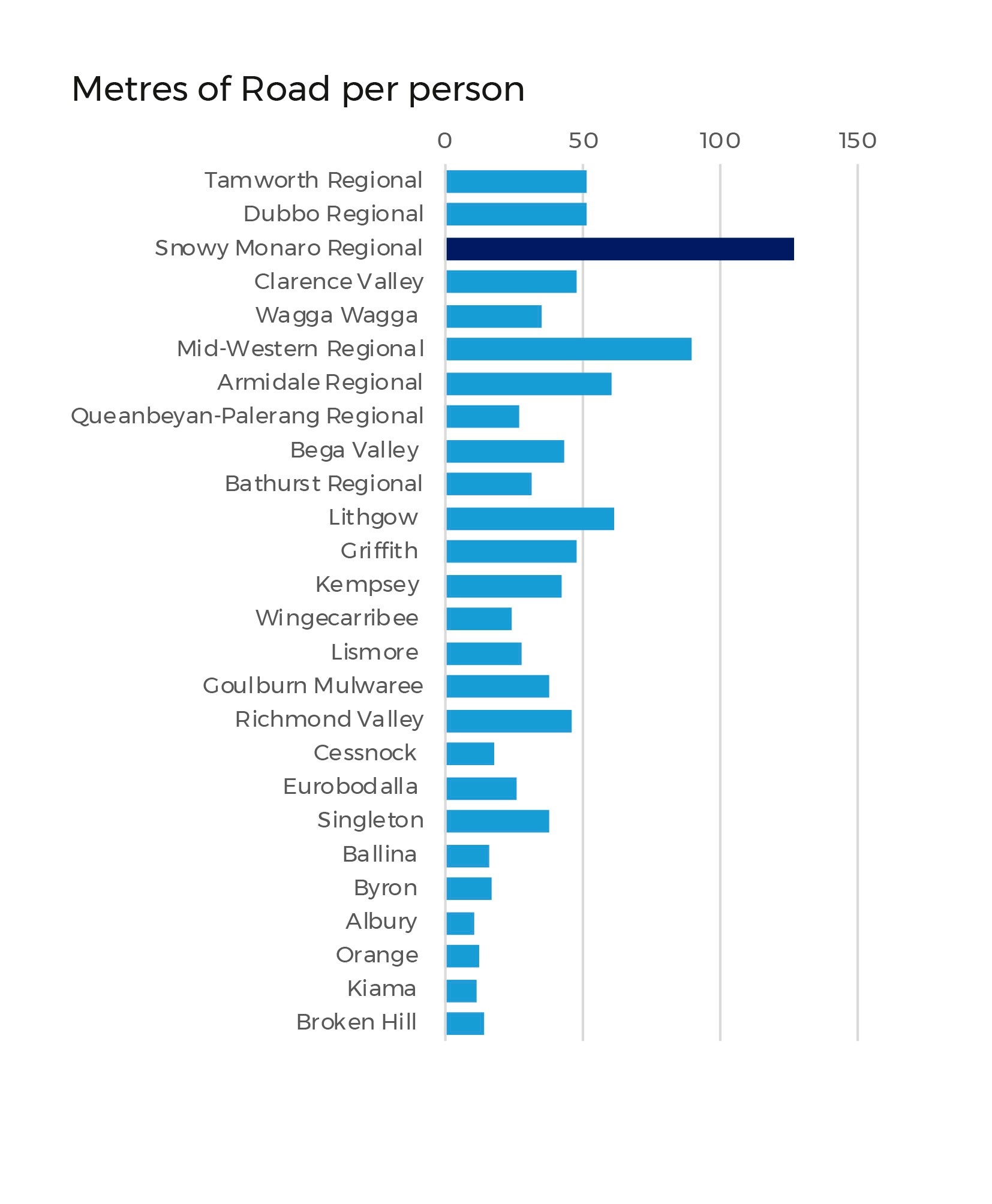
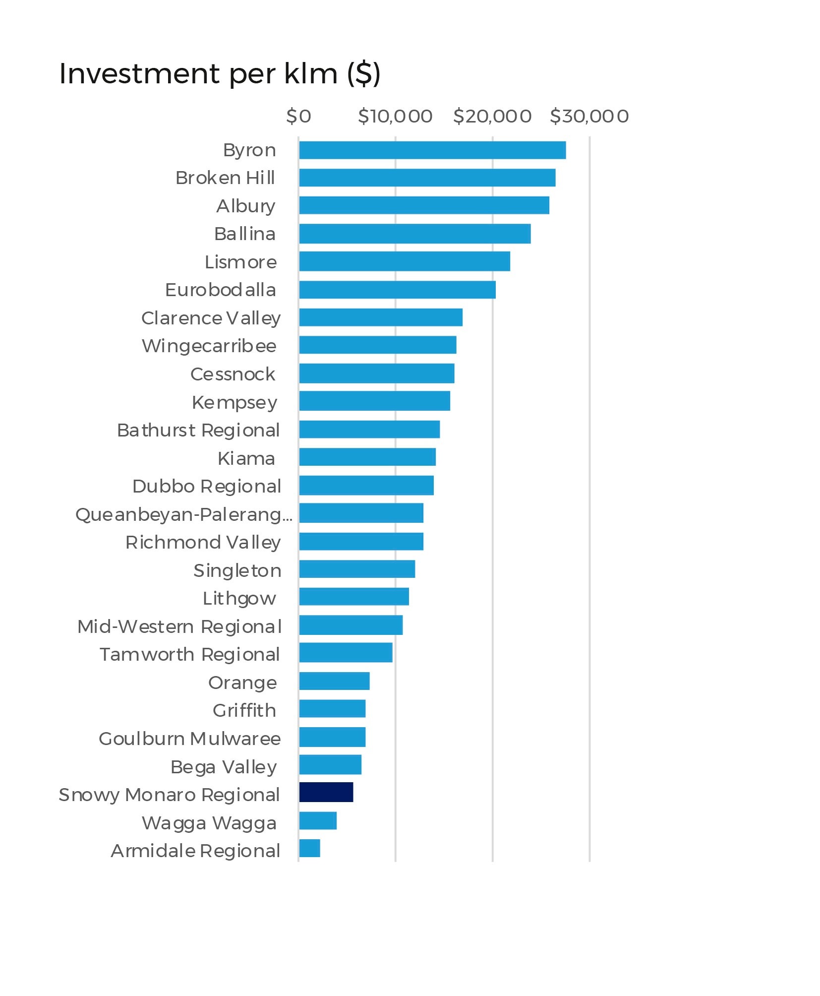
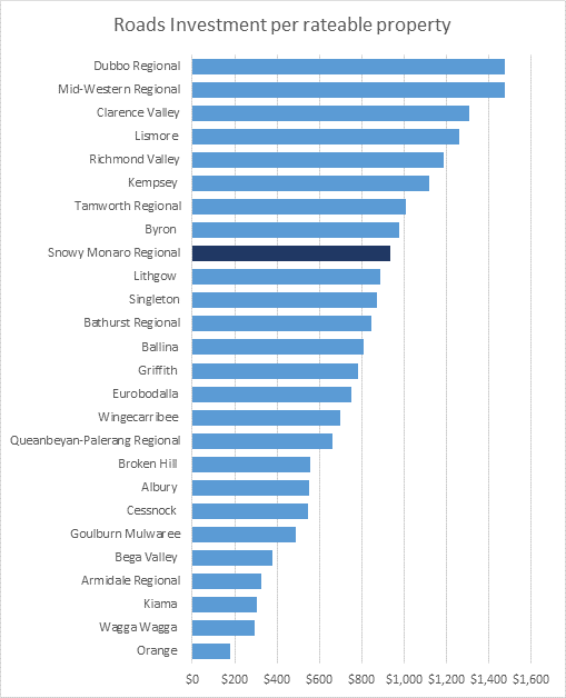
The included graphs show just how we fare in terms of roads and maintenance compared to some other councils – showing lengths of road, investment per km and more.
This is all background info to help you understand the bigger picture of our finances, rate options and what the future of your region may look like. We need you to have input and have your say – visit www.yoursaysnowymonaro.com.au today.